
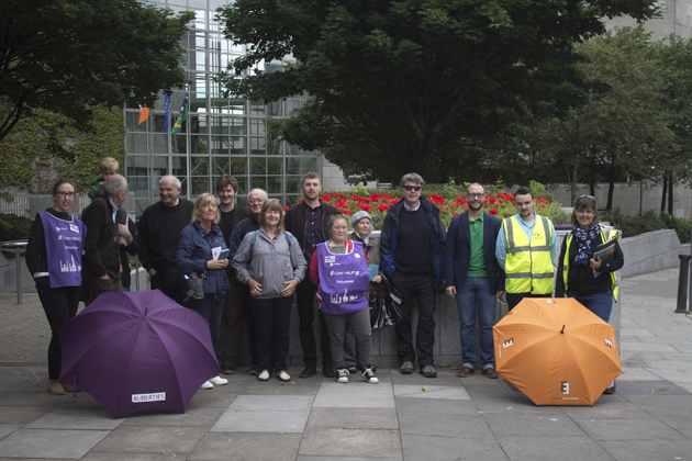
Figure 1: Group standing outside the Dublin City Council Offices
As part of Heritage Week 2015, City Architects/Conservation designed a walking tour of along the ‘Slighe Mór’, the great ancient Western route. The tour followed the format of the successful Aungier Street walking trail – the narrative of the city’s cultural heritage enlivened by the findings of archaeological excavations with specially arranged visits to site currently under development with surviving historic fabric. Guides included Dublin City Conservation Officer, Nicola Matthews, architect Aisling Kehoe and Archaeologist Cian O’Raghallaigh.
Such was its importance that the Anglo-Normans referred to Thomas and James’s Street collectively as the ‘Great Street’. In medieval times a number of ecclesiastical orders settled in the area including the Augustinian abbey of St. Thomas the Martyr, later known as Thomas Court, from which the street takes its name. The area was granted ‘liberty’ status in the early fourteenth century and as a result, it was free from tariffs and outside the control of the Mayor and City Assembly. The Liberty of St. Thomas rapidly developed during the second half of the 17th century primarily as a result of its ample water supply and plentiful land. The ancient Glib Stream, originally flowed down Thomas’ Street and fed water into the medieval city – its surplus was re-directed into the moat that ran around the city’s walls.
Due to its ample supply of water, Thomas Street acted as the watercourse to the old city for centuries. As a result of increased growth and development, the city authorities were required to greatly increase water supply to the city during the 13th century. This led to the supplementation of the Glib Stream by harnessing part of the River Poddle to feed into an open channel near Dolphin’s Barn and to supply a cistern near James’s Street, from which water was conveyed to the city. From this time the control and management of water in this area of the city ultimately informed its industrial development and character.
Travelling along the east – west route the walking trail highlighted a number of significant sites that epitomised the scale, enterprise and character of the area. At the eastern end of Thomas Street, once stood Corn Market House. It stood strategically just outside the city walls and was the city’s principal corn market, until it was removed by the Wide Streets Commission in 1818.
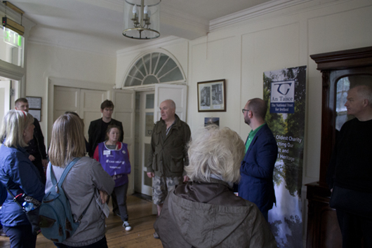
Figure 2: Ian Lumley, An Taisce inside Tailor’s Hall
Not far from where Cornmarket House once stood is Tailor’s Hall – the oldest surviving Guild Hall in Dublin. It was built between 1703-7. In the 18th century, it was concealed behind houses on High Street and Back Lane. It fell into disrepair, virtually derelict by the 1960s and was restored by the Irish Georgian Society from 1968-71 and again by An Taisce in the 1980s, from which they now run their offices.
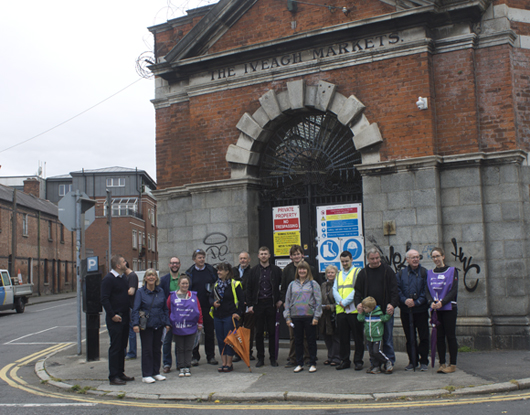
Figure 3: The tour outside the ‘wet’ market of the Iveagh Markets
As part of Lord Iveagh’s (of the Guinness family) philanthropic endeavours and arising from an Act of Parliament in 1901, the rights of street traders to operate a market on Patrick Street were extinguished to make way for St. Patrick’s Park and the Bull Alley complex of housing and the Iveagh Markets. The covered market to Francis St sold old clothes and a ‘wet’ market to John Dillon St for fish, fruit and vegetables. The Iveagh Markets was designed by Frederick Hicks in a Neo-Georgian Style and it acted as a significant regenerating boost in the area and complemented the Plunkett St / John Dillon St housing scheme built by the Dublin Artisans Dwellings Company. It’s been closed as a market since 1990.
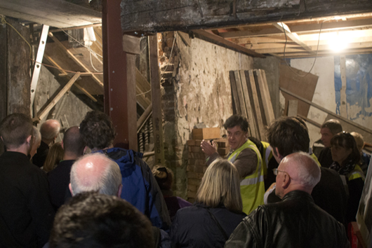
Figure 4: David Averill of Sheehan Barry Architects describing the layers of history being uncovered as part of their on-going works to No.130 Thomas Street
One of the highlights of the walking tour was the access for the first time to No. 130 Thomas Street – currently undergoing extensive conservation. No. 130 Thomas Street is now considered to be one of the oldest buildings on the street, dating around 1660s which an even earlier staircase dating from 1627. Dendrochronology tests suggest that the staircase was removed from an earlier building and incorporated into No. 130 at the time of construction. As one of the earliest buildings to Thomas Street it is structurally independent from its neighbours, and was originally conceived as a fully detached, three storey in height timber framed structure with a steep roof, dormer windows and over hanging eaves. At some point, the roof was removed and, as is the case with many historical buildings, another floor was added. The roof today is of a more recent C19th profile, fully repaired in 2014 to save the building. Works to stabilise the interior fabric have yielded exciting discoveries in relation to the early timber staircase and detail hitherto unknown in Dublin have come to light – the evidence suggests that the risers of the stairs were cut and decorated to imitate the profile of a stone stairs to enhance the presentation of this merchant’s house.
Nos 30, 32-36 Thomas Street comprise a significant part of the historic streetscape that frames St. Catherine’s classical entrance front – the street-fronted structures vary in date and are currently the subject of a planning application for re-development with the historic buildings at the core of the proposed student housing complex. Conservation Architect, Alistair Lindsay, was on hand to describe the current condition and the historical finds from the houses – including archaeological remnants that may be associated with Thomas Court embedded in an C17th/ C18th brick industrial structure.
In more recent times the over-layering of the ancient route took place and many buildings were removed and replaced with mercantile buildings that provide its present day character. The western quarter became the original industrial suburb of Dublin, with an extensive tradition of brewing, distilling, tanning, weaving and trade in agricultural produce. The pinnacle of development was in the 19th century when the area was dominated by great brewing and distilling families, most notably Guinness who from 1759 built the world’s largest brewery at St James Gate. Renowned distillers Powers, Jameson, Millar and Roe were all located here, creating a Victorian cityscape of chimneystacks and mills. The site of the Guinness brewery was founded circa 1670 by Giles Mee, a former Lord Mayor of Dublin, and Arthur Guinness began operating his brewery from No.1 Thomas Street in 1759.
By 1833 Guinness had become the largest brewery in Ireland and when Arthur Guinness’s grandson, Benjamin Lee Guinness took over the running of the brewery in 1855 it was the biggest in the world. No 1a to 6a Thomas Street is referred to as the ‘Dwelling House’ in early maps and was included in the original lease (9000 year lease). Various members of the Guinness family lived here until 1855. The interior still retains a fine open well timber staircase. They front the 54 acre St. James’s Gate Brewery. Today the St. James Gate Dublin Brewery is the most technologically advanced and environmentally efficient in Europe and the area has become synonymous with the area.
Just outside what is now known as St. James’ Gate, would have stood the medieval St. James Gate, a defensive feature that protected the western entrance to the city. It also acted as a toll-gate and would have spanned the width of the street. The gate dated from the 15th century and was thought to be have been demolished sometime between 1850 and 1910. The gate was also seen as the traditional starting point for pilgrims on the Camino de Santiago. (The Roman Catholic Church of Saint James still stamps passport for people who undertake the pilgrimage).
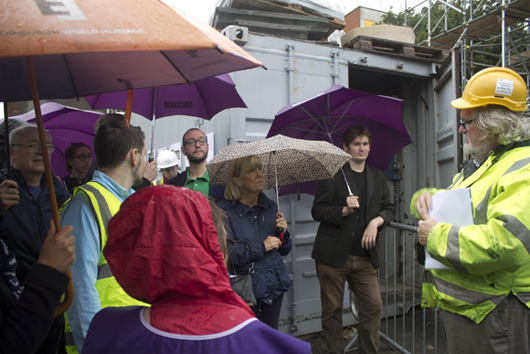
Figure 5: Peter Cox of Carrig Conservation, describing the history of and on-going refurbishment works to St. James’s Church
The tour reached its conclusion at the end of James Street which is terminated by a significant fountain, built in 1790 by the Duke of Rutland, the Lord Lieutenant of Ireland from 1784 to 1787. A funeral custom still remembered in the area, involved carrying the coffin around the fountain three times prior to burial in St James graveyard.
Peter Cox, Conservation consultant provided an exciting insight into on-going conservation works at St. James (former Church of Ireland) – the restoration of the lost spire in a contemporary fashion, the conversion of the vacant church into a boutique distillery/visitor centre, which will provide access once again to this significant site and its history.
The trail were given unprecedented access to a number of on-going projects along the street and we would especially like to thank:
Ian Lumley, An Taisce
David Averill and Shane O’Connor, Sheehan Barry Architects,
Alistair Lindsay, Lindsay Conservation Architects
Peter Cox, Carrig Conservation.