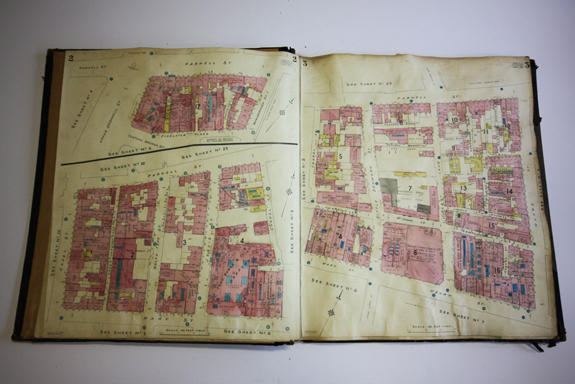
During Dublin City Architects recent and ongoing research of The Aungier Estate we discovered what we believe to be one of the earliest surviving original 1893 Charles E. Goad’s Fire insurance plans of Dublin City centre.
The historic fire insurance plans were found right here in Dublin City Council Offices on Wood Quay. The plans were entrusted to the councils Law Department after being salvaged from the basement in City Hall, which at the time was being cleared of its contents.
History of the Plans
Fire insurance policies first emerged in the late 1600’s in London as a result of the Great Fire of 1666. Wealthy merchants and the aristocracy took out government sponsored fire insurance policies to protect their properties and business ventures against the ever present threat of fire. By 1750, such policies became accessible to all classes who wanted to protect their homes and livelihoods. When the Industrial Revolution began to kick into high gear by 1780, fire insurance companies began looking for ways to protect themselves against costly losses by having a more clear record of what they were actually insuring. The result was the creation of the first fire insurance plans which detailed, street by street, the buildings present plus their construction materials and usage.
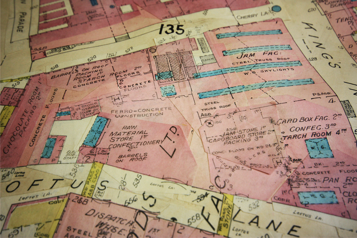
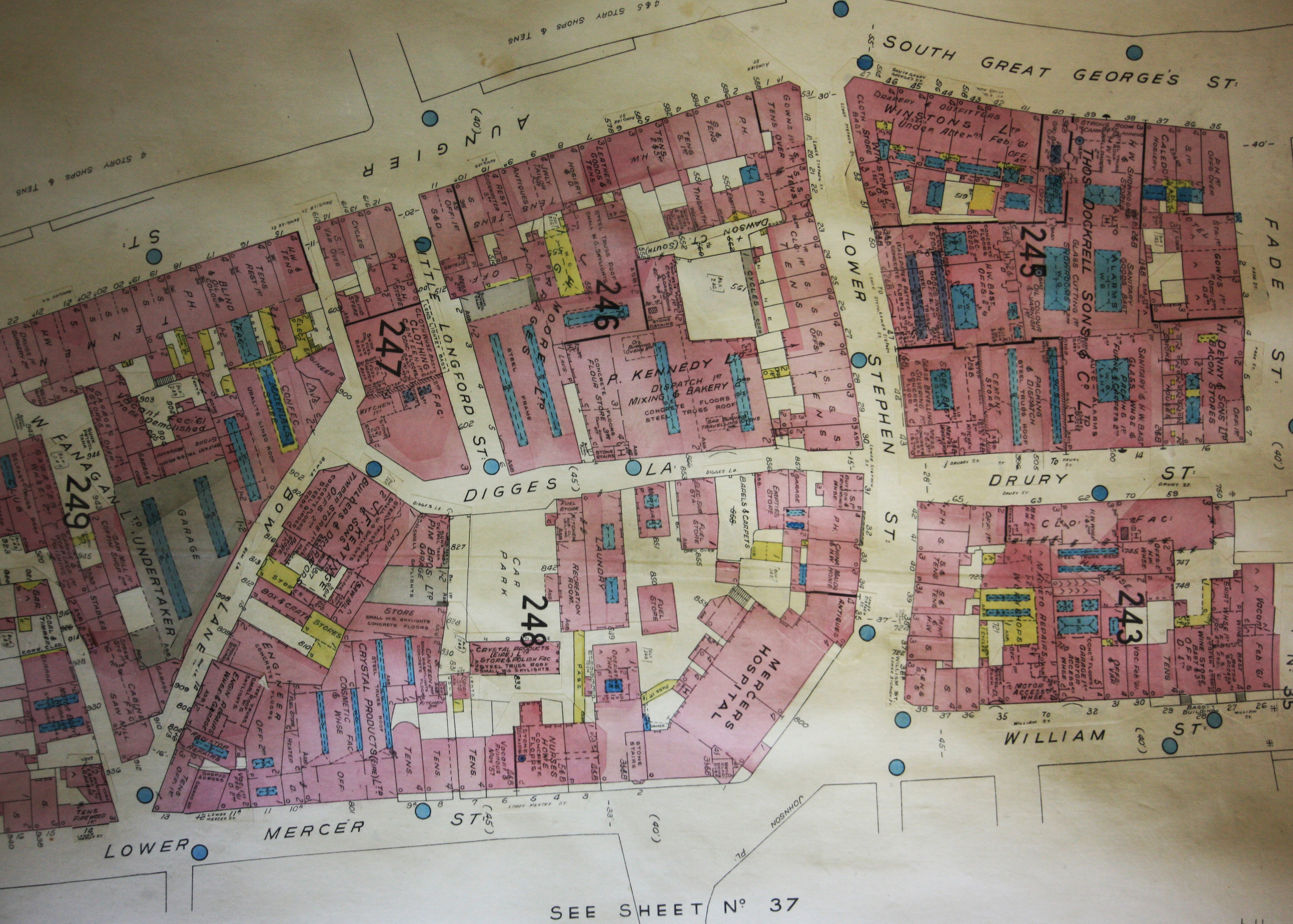
The fire insurance plans were also used as an invaluable tool for researchers, planners, architects and insurance adjusters. The fire insurance plans tell us a lot about the history of Dublin city. They show us what materials a building was constructed from and also other information such as size and location of individual buildings, access to water, land use, number of storeys, and routes to buildings, room arrangements, locations of doors & windows, thickness of walls, information on construction materials, type of roof and locations of combustible materials.
The Goad Company had a policy of only leasing the maps to insurance companies. The maps were then returned to Goad when updates were available; this happened on a regular basis. It is this updating, [last noted 1961] by means of gluing additional strips of paper on top of the original map and then updating the information [see image above] that makes this set of Fire insurance plans very rare and suggests that they are indeed one of the earliest original Charles E. Goad’s of Dublin City centre.
Future of the Plans
The Fire insurance plans are an important part of the Architectural record and insight into what the city of Dublin looked like in the mid nineteenth and late twentieth century. They also provide us with a valuable insight into the craft of map making during this time. The Fire insurance plans are currently being scanned by the Survey and Mapping department in Dublin City Council. Once completed the original plans will be sent to the City Archive for appropriate conservation and archive storage.